
Elmhurst ZIP Coverage in Context
Official sources show one clear core postal ZIP and three statistical ZCTAs that touch the Elmhurst place. A ZCTA is the Census Bureau's approximation of a ZIP area for statistics. It is not a list of delivery addresses. The four rows below therefore describe different kinds of evidence, not four interchangeable Elmhurst mailing codes.
| ZIP or ZCTA | Areas Covered | Post Office | Notes |
|---|---|---|---|
| 60126 | Core Elmhurst delivery area | Elmhurst, 154 W Park Avenue | City Hall, Library, and Museum use 60126 |
| 60163 | Census intersection at an edge | Postal label not confirmed in research | Check every full address with USPS |
| 60181 | ZCTA or ZIP touching Elmhurst | Villa Park | Postal city is Villa Park |
| 60523 | Boundary, institutional, or commercial edge | Oak Brook | Not a general Elmhurst ZIP |
The Elmhurst ZIP code directory keeps those distinctions intact. Census association means that a statistical area intersects the legal place. It does not mean an address may choose any of the listed ZIPs. USPS remains the address-level authority, and DuPage parcel data can confirm the situs address used for a property record.
None of the four rows is a resident count. Research did not locate a verified Elmhurst registration total by ZIP or precinct, so the table avoids false population claims. Census data can summarize a ZCTA, but those figures describe the statistical shape, including any area outside the city. The correct unit must be named beside every number.
Elmhurst ZIP Code 60126
Official city addresses make 60126 the firm starting point. Elmhurst City Hall, the Public Library, and the History Museum all use it. The Elmhurst Post Office is at 154 W Park Avenue and displays 60126-3380. That longer code belongs to that delivery address. It is not a neighborhood identifier that can be copied to another building.
Use the USPS ZIP Code Lookup in address mode when a street sits near a city edge. City and state mode can list postal codes tied to a place name, while cities-by-ZIP mode can return postal place labels. Neither route replaces the full-address result.
Postal routing can also produce labels that look broader than the actual delivery area. Nearby post offices or sorting relationships do not redraw Elmhurst. A USPS Postal Bulletin route may show how mail containers move, not where the legal city line sits. When a form rejects a familiar city name, enter the USPS-approved address exactly, then retain the municipal name separately for city records. This avoids silently changing Villa Park or Oak Brook mail into an Elmhurst address merely because the Census reports an intersection.
Four ZCTAs Touch Elmhurst
The Census relationship for Elmhurst includes 60126, 60163, 60181, and 60523. This is one of the most useful local geography facts, but it is also easy to overstate. Census ZCTAs follow Census blocks and support statistical summaries. ZIP Codes are built by USPS for mail delivery. Their shapes and purposes differ.
Review the Census ZCTA explanation before treating a statistical boundary as a postal result.
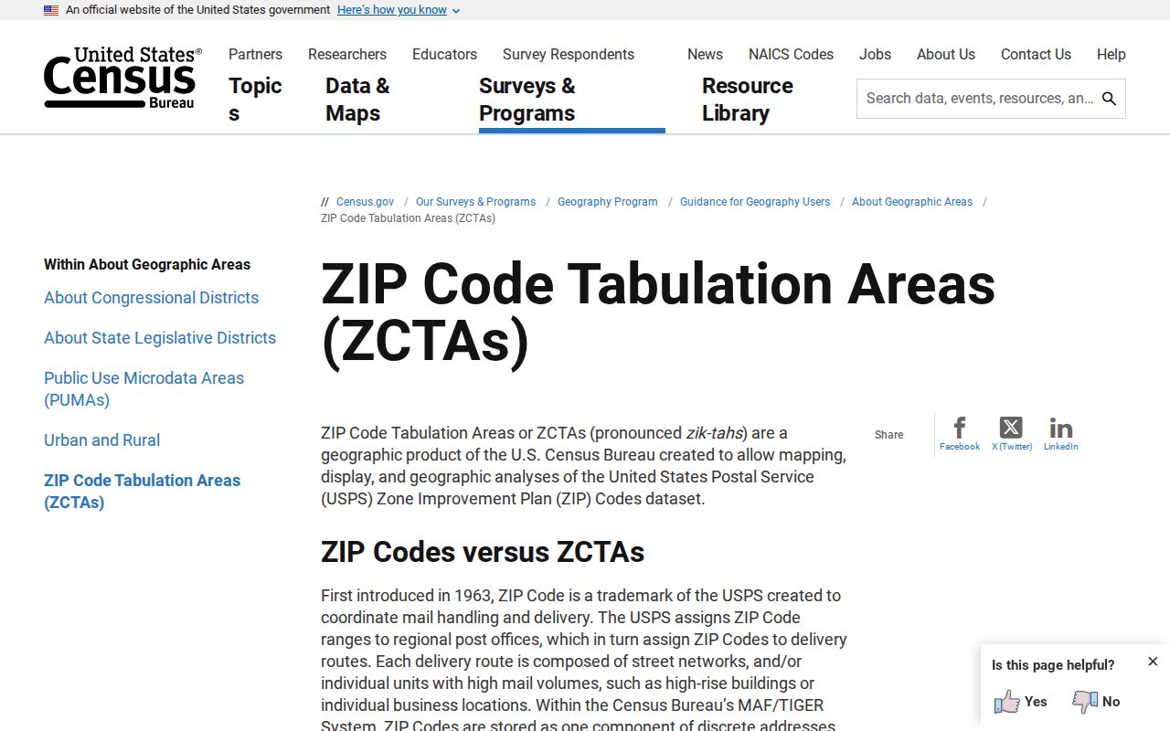
The captured Census guidance explains why noncontiguous, mixed-delivery, PO-box-only, or institutional patterns do not behave like city limits.
Find Elmhurst Residents by ZIP
No verified DuPage portal offers a public export of every resident in one ZIP. The property portal can display the city, state, and ZIP in its situs and billing fields after a parcel has been resolved. GIS accepts an address, partial street, PIN, or subdivision, but its official help did not expose a ZIP filter. The voter address form asks for city and street parts, not ZIP. A sound ZIP code directory workflow works from a precise address outward.
- Enter the complete delivery address in USPS ZIP Lookup. Save the five-digit ZIP and use ZIP+4 only for that exact address.
- Search the DuPage property portal by address or PIN. Read the situs ZIP and billing ZIP as separate fields.
- Use DuPage GIS to map the resolved parcel when a municipal edge or subdivision creates doubt.
- For polling or district facts, enter the house number, street name, direction, suffix, and Elmhurst in the voter address search.
- Move to the Elmhurst street directory when the task becomes a street or parcel search rather than a postal one.
A property owner can be a person, trust, company, or other legal owner. Billing mail may go elsewhere. Neither field is a full household list. Keep the parcel PIN as the stable join when an address spelling changes.
DuPage voter search has the same need for exact syntax. The street-name field takes the name without its direction or street type. Direction and suffix are chosen in their own controls, and the city comes from a dropdown. That design can make a valid address fail when a user types the whole street line in one box. The result is election and district information, not an open list of all people in the ZIP. A name search also asks the voter for identity details, so it should be used for the person's own registration check.
Elmhurst ZIP Fields on Parcels
The DuPage property profile is useful because it separates the property location, called the situs address, from the owner or billing address. A same-ZIP match can support an address check. A different billing ZIP may simply mean tax mail goes to another place. It does not prove that the parcel is outside Elmhurst or that the named owner lives at the billing address.
Open the official Elmhurst parcel profile to see the address field pattern.
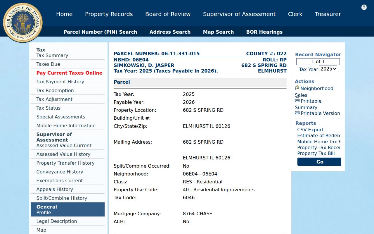
The parcel screen ties a ZIP result to a PIN and situs, which is more reliable for county record work than a postal place name alone.
| Search field | Input or result | ZIP use |
|---|---|---|
| Street address | Address search input | Resolve the parcel before reading ZIP |
| PIN | Four-part parcel number | Stable join across county pages |
| Property or situs address | Parcel result | Read the location city, state, and ZIP |
| Billing address | Owner-mail result | Do not confuse with the property location |
| Map search | Visual control | Compare a parcel with city-edge geography |
Elmhurst ZIP and Voting Geography
DuPage voter tools divide geography by address and district, not by an open ZIP-wide resident list. Address Search requires the house number, bare street name, separate direction, separate suffix, and city. District Search can return polling location, precinct, precinct committeeperson, or sample-ballot information after a district type and district are chosen.
The Illinois voting systems page describes public search and voter-data administration.
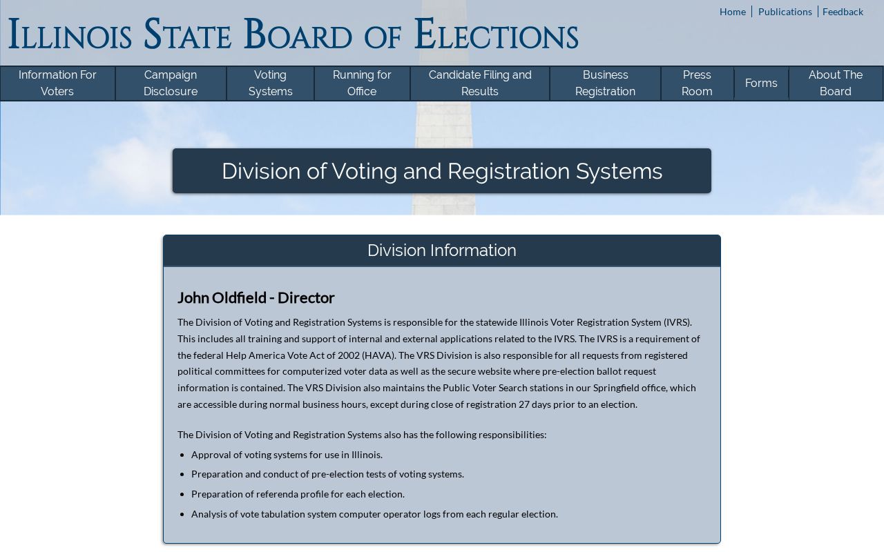
The state screen supports election-geography research, while the DuPage address form supplies the local street syntax. Neither should be described as an Elmhurst household export.
Bulk voter data is a separate, restricted state channel. Illinois provides it to eligible political committees for bona fide political purposes, not as a casual ZIP directory. The public file no longer includes date of birth. Prices and formats can change, and voting history shows participation rather than a marked ballot. For an ordinary address question, the county's address and district tabs are the narrower and safer route.
Old Elmhurst Records Predate ZIPs
Historical names and boundaries can matter more than a modern ZIP code. The settlement was known as Cottage Hill before the Elmhurst name took hold in 1870. It became a village in 1882 and was reincorporated as a city in 1910. Old directories, maps, and newspapers may use those terms rather than a modern postal code.
The History Museum's maps cover Elmhurst in 1885, 1910, 1933, 1949, 1974, and 2023. Its holdings also include subdivision, annexation, construction, and Sanborn maps. If an old number fails, test the street alias, village or township label, subdivision, nearby owner, and map block. No verified citywide renumbering schedule was found, so a guessed conversion would be unsafe.
Downtown records often use York Street, the Union Pacific West rail line, Park, First, Church, Prospect, Cottage Hill, or Haven as place terms. A historic note may say “near the station” or “near the college” instead of giving a modern postal address. Match that wording to the map for the same era. Sanborn years can show a structure footprint and street alignment, while directories or newspapers can supply a name. Neither source should be forced to answer the other's question.
Elmhurst ZIPs Versus City Limits
The Elmhurst ZIP code directory treats Villa Park 60181 and Oak Brook 60523 as warnings against reading a ZIP as a municipal border. Each touches the Elmhurst place in Census geography, yet USPS associates those codes with neighboring postal cities. The 60163 intersection also requires an address-by-address check because a stable postal label was not confirmed during research.
City and county maps show Elmhurst beside Villa Park, Lombard, Addison, Oak Brook, Oakbrook Terrace, Hillside, Northlake, and Bensenville. Edge parcels can cross postal, taxing, school, and municipal systems in different ways. A tax-jurisdiction list is not a household record or school attendance map.
- ZIP Code
- A USPS delivery code assigned through postal operations.
- ZIP+4
- An address-specific extension that narrows a delivery segment.
- ZCTA
- A Census statistical area that approximates ZIP geography using Census blocks.
- PO-box ZIP
- A code used for post-office boxes rather than a standard street-delivery area.
- Unique ZIP
- A code assigned to one large organization or delivery point.
- Carrier route
- A mail-delivery path that does not define a city neighborhood.